Elephant Fire Grows to 12,303 Acres Near Loyalton
Evacuations remain active as crews battle fast-moving fire across three counties.
3 min read
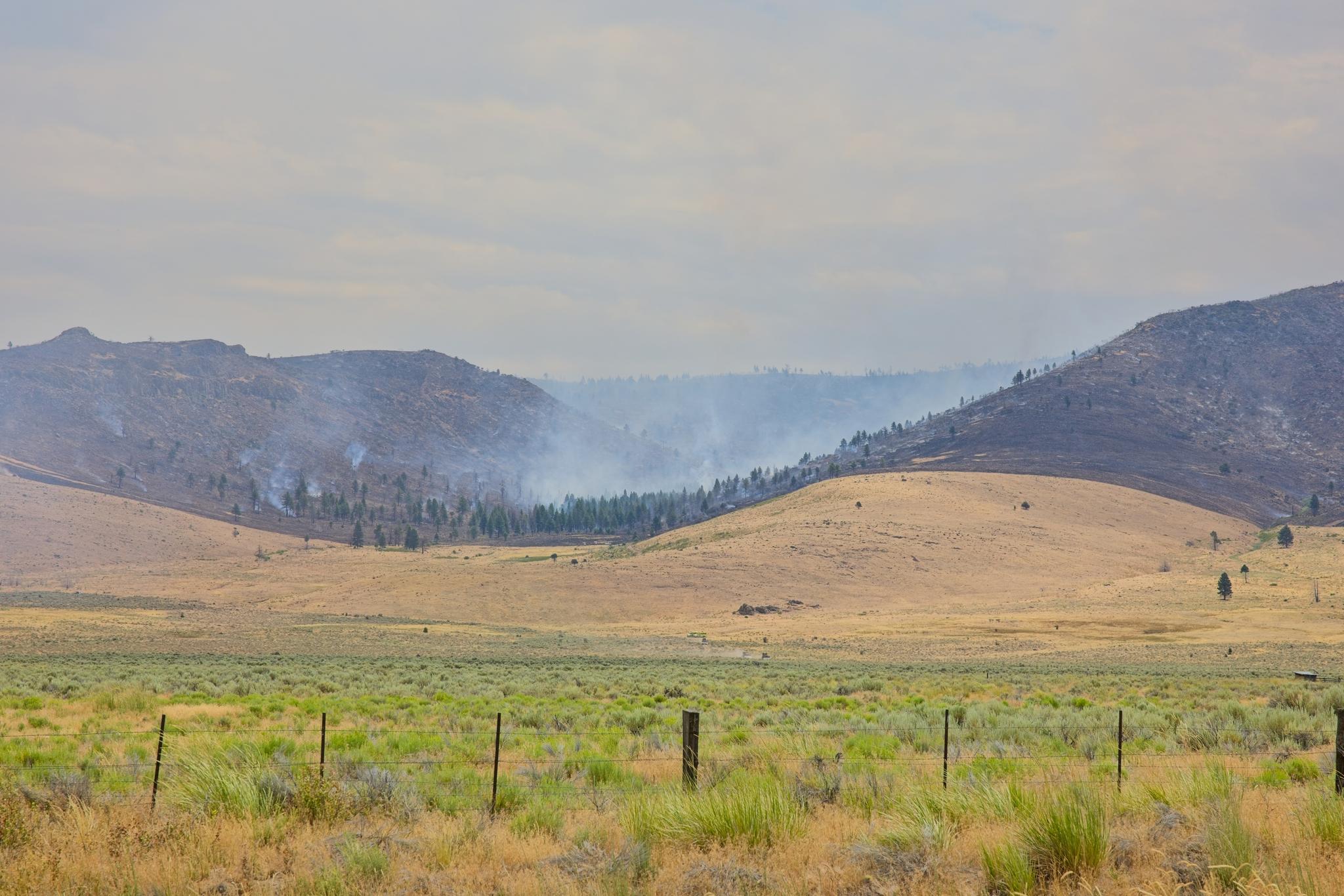
Smoke rising from the Elephant Fire near Highway 49 at the Sierra-Plumas County border at noon on Monday.
LOYALTON — The Elephant Fire has burned 12,303 acres north of Loyalton and is 5% contained as of 2:12 PM Monday, July 13, according to CAL FIRE’s incident page. An evacuation order remains in effect in Lassen County, with additional evacuation warnings in Lassen and Plumas counties.
InciWeb reported the fire at 1:27 PM Saturday, July 11, about two miles northeast of Loyalton on Tahoe National Forest land. CAL FIRE posted an initial estimate of 200 acres at 3:04 PM Saturday. An aircraft later mapped the fire using infrared technology, finding it to be 2,157 acres by 3:50 PM. At 6:08 PM, officials reported 2,300 acres and 5% containment.
The fire remained active overnight, spreading northeast through grass, sagebrush, timber litter, snags, and heavy dead fuels within the 2020 Loyalton Fire burn scar. The reported acreage rose to 6,436 by 4 PM Sunday, then nearly doubled to 12,303 by 1:59 PM Monday. Incident managers said ridgetop winds, dry fuels, and difficult terrain challenged suppression work.
InciWeb listed 430 personnel assigned to the fire at 12:48 PM Monday. The U.S. Forest Service was leading the response under Incident Commander Joe Griffin, with support from CAL FIRE’s Nevada-Yuba-Placer Unit, Loyalton Fire Department, Truckee Meadows Fire Protection District, and other local, state, and federal partners. The Sierra, Lassen, and Plumas County sheriff’s offices were handling evacuation actions and other public-safety duties in their jurisdictions.
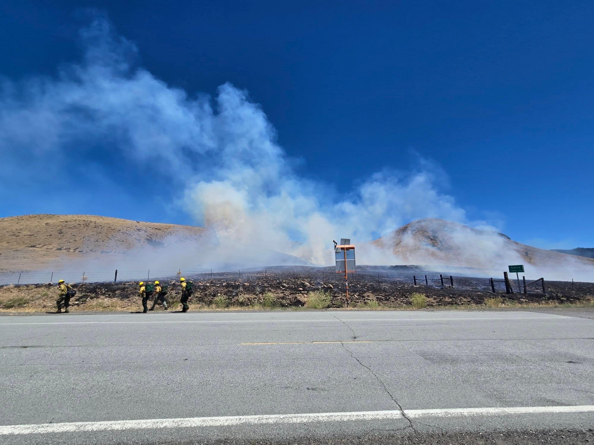
Firefighters respond to the Elephant Fire on Saturday. Credit: Sierra County Sheriff’s Office.
In the effort to contain the fire, fireline has been built where terrain and conditions allow, and aircraft continue to drop retardant and water. The Truckee Tahoe Airport reported that it had supported three CH-47 Chinook helicopters assigned to overnight operations. Firefighters were using a direct, full-suppression strategy where they could work safely.
The first evacuation action began at 3:14 PM Saturday, when Lassen County zone LAS-451-A was placed under an evacuation warning. The zone was upgraded to an evacuation order at 3:51 PM Sunday, requiring people in the area to leave immediately. Lassen County zone LAS-671-B was placed under an evacuation warning at 4:16 PM Sunday.
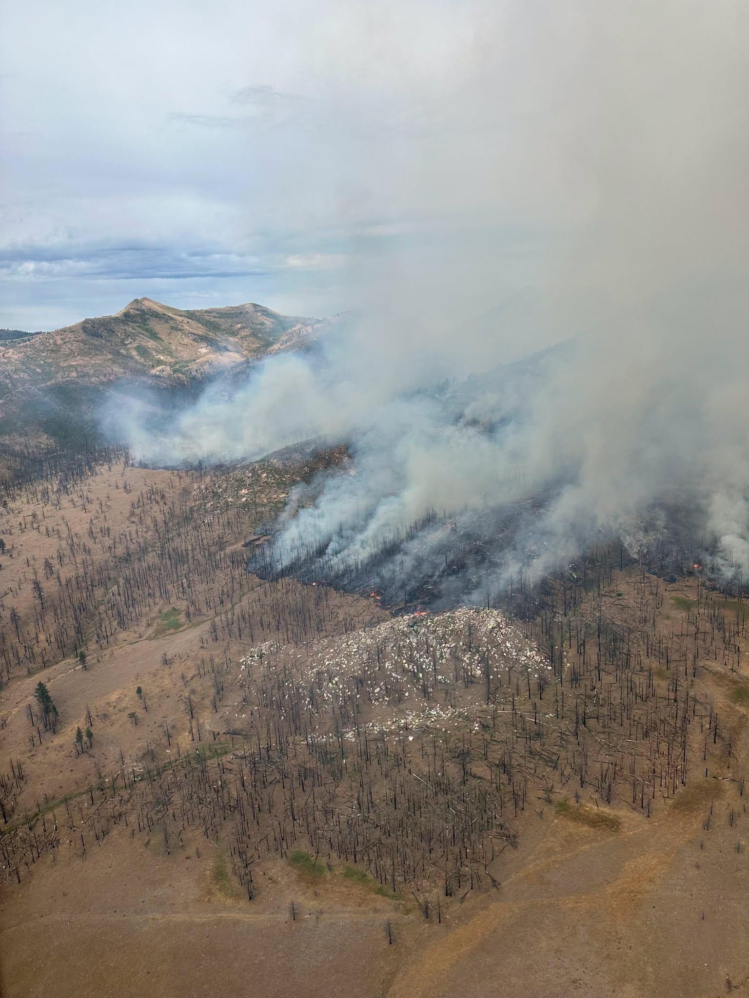
An aerial view of the Elephant Fire on Sunday, July 12. Credit: Tahoe National Forest.
Plumas County zones PLU-104-A and PLU-114 were placed under evacuation warnings at 5:17 PM Sunday. The Plumas County Sheriff’s Office described the warning area generally as south of Chilcoot to the Sierra County line and east of Vinton to the Lassen County line. No Sierra County evacuation order or warning has been issued.
Evacuation conditions can change quickly as the fire moves. Residents should verify their zone and current status through Genasys Protect and official county sheriff’s office notices. Lassen County residents needing evacuation or shelter information may call 530-254-4500.
The official cause of the fire remained under investigation Monday, with CAL FIRE conducting the inquiry. “I would be very comfortable to say it was human-caused,” Sierra County Sheriff Mike Fisher told The Mountain Messenger. He noted, however, that the exact cause remains unknown, as well as whether the fire began intentionally or accidentally.
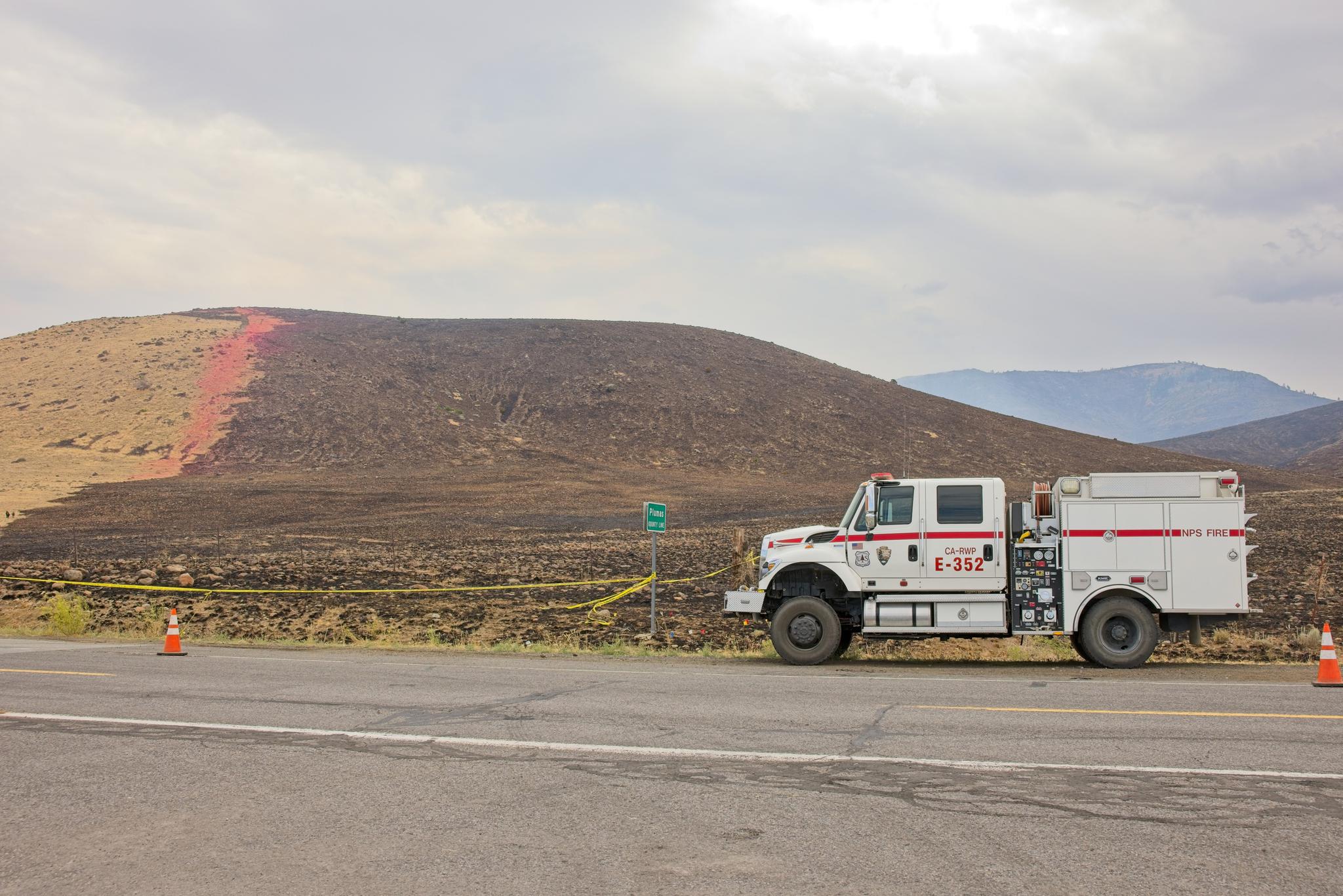
The burn scar of the Elephant Fire bordering Highway 49 at the Plumas-Sierra County border.
Firefighters also dealt with an increasingly common hazard: illegal drone operation. In a notice posted at 11:03 PM Sunday, the Sierra County Sheriff’s Office said a citizen had reported an illegal drone near active fire-suppression operations earlier in the afternoon. Deputies used publicly available information to identify a person believed to have operated the drone.
The sheriff’s office said some aerial operations were temporarily grounded and that its preliminary investigation indicated the drone flew above the legal altitude and within the wildfire’s temporary flight restriction. The case is being referred to the Sierra County District Attorney’s Office, with additional coordination planned with the Federal Aviation Administration.